Index of /tcdata/flight/applications/plots/v1.3/2005/nate/earth_relative
Name
Last modified
Size
Description
Parent Directory
-
nate_earth_relative_plotting_summary.txt
2018-03-27 18:25
24K
plot_flight_track_nate_2005_all_flights.png
2018-03-27 18:24
213K
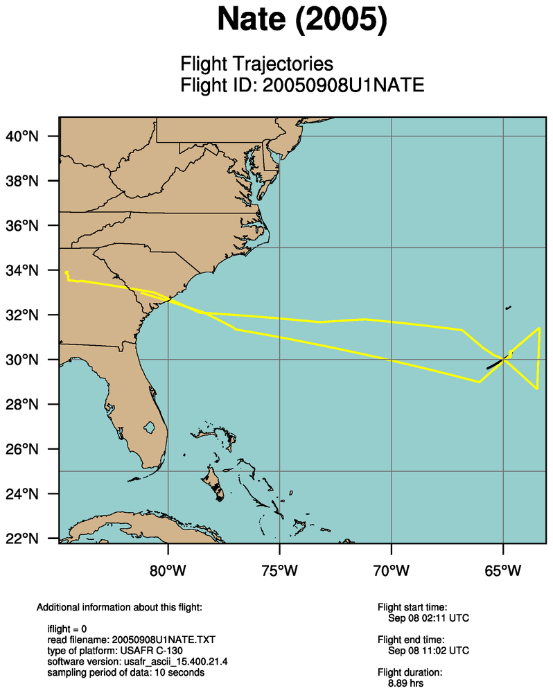
plot_flight_track_nate_2005_single_flight_0_20050908U1NATE.png
2018-03-27 18:24
213K
plot_flight_track_with_flight_level_pressure_nate_2005_all_flights.png
2018-03-27 18:24
233K
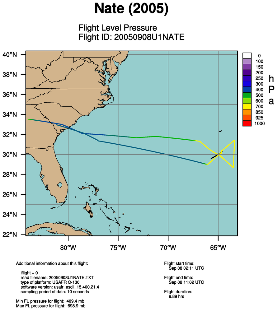
plot_flight_track_with_flight_level_pressure_nate_2005_single_flight_0_20050908U1NATE.png
2018-03-27 18:24
232K
plot_flight_track_with_flight_level_temperature_nate_2005_all_flights.png
2018-03-27 18:25
227K
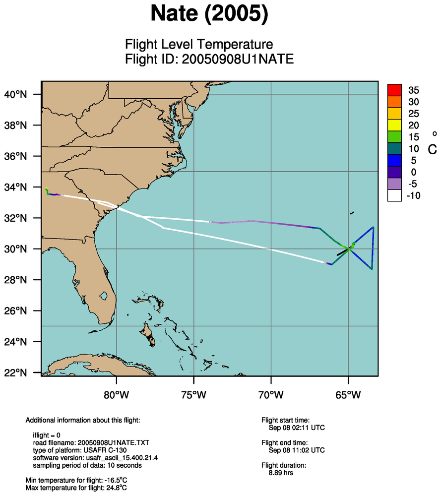
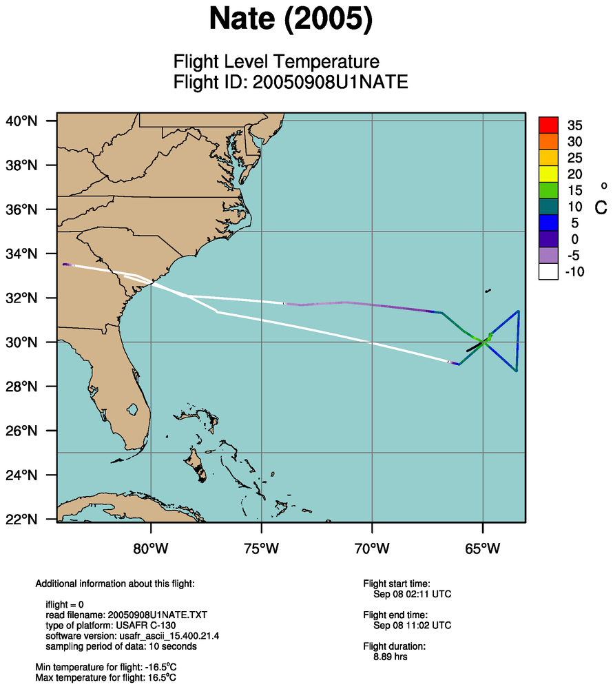
plot_flight_track_with_flight_level_temperature_nate_2005_single_flight_0_20050908U1NATE.png
2018-03-27 18:25
225K
plot_flight_track_with_flight_level_wind_speed_nate_2005_all_flights.png
2018-03-27 18:25
230K
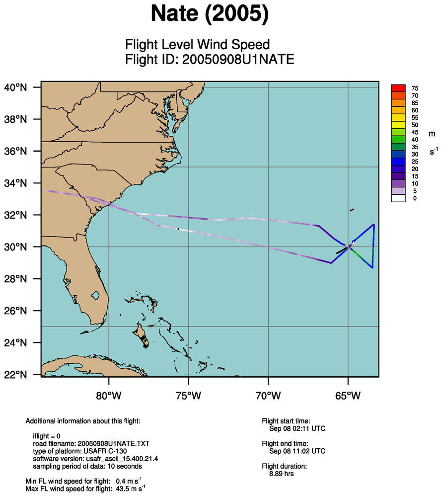
plot_flight_track_with_flight_level_wind_speed_nate_2005_single_flight_0_20050908U1NATE.png
2018-03-27 18:25
227K
plot_flight_track_with_sea_level_pressure_nate_2005_all_flights.png
2018-03-27 18:24
245K
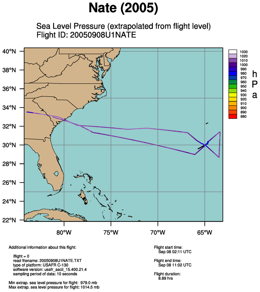
plot_flight_track_with_sea_level_pressure_nate_2005_single_flight_0_20050908U1NATE.png
2018-03-27 18:24
243K
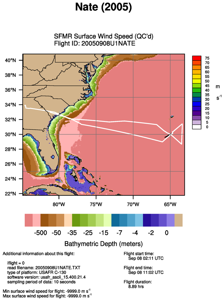
plot_flight_track_with_sfmr_surface_wind_speed_quality_controlled_nate_2005_all_flights.png
2018-03-27 18:25
271K
plot_flight_track_with_sfmr_surface_wind_speed_raw_nate_2005_all_flights.png
2018-03-27 18:25
271K
Apache/2.4.66 (Debian) Server at verif.rap.ucar.edu Port 443